
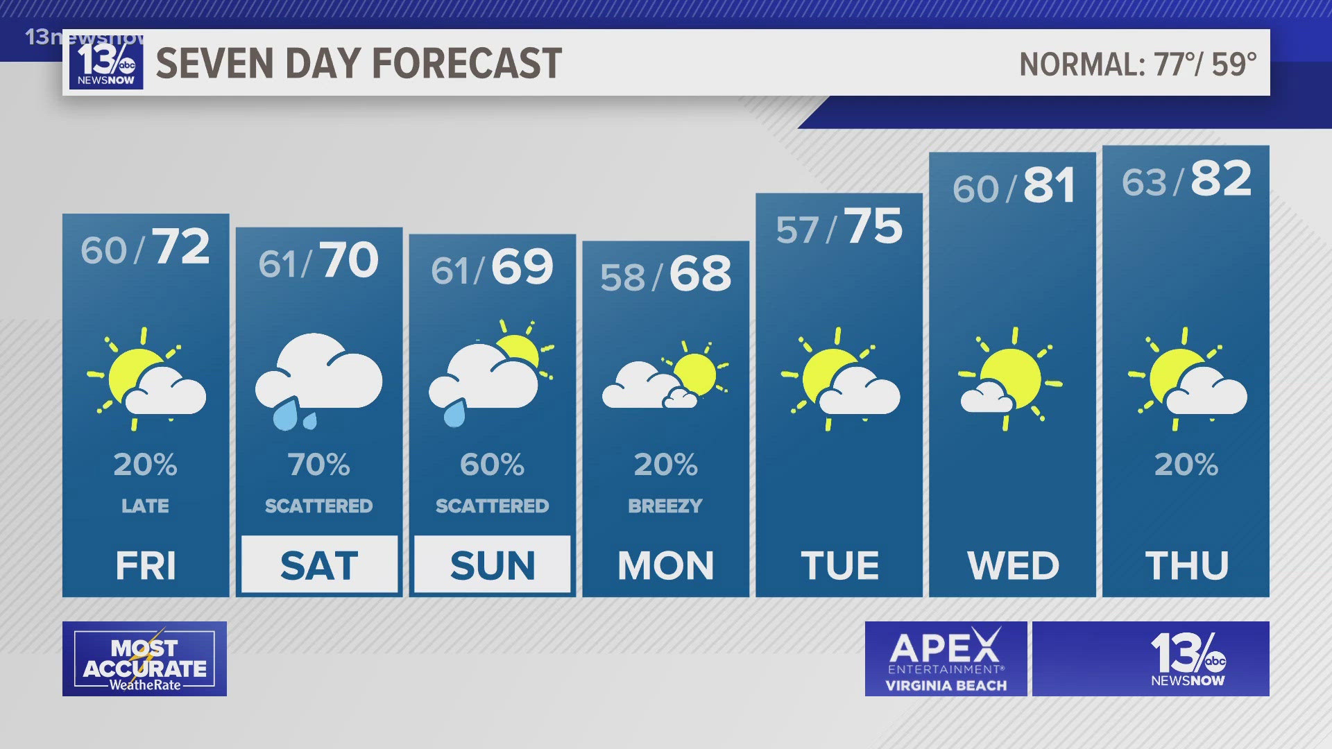
NORFOLK, Va. — Clouds will increase today. Our Friday will be dry for most of the region, but isolated showers will develop late to the west. Temperatures will settle back into the lower to middle 70s during the afternoon.


Our next low-pressure system will bring chances for showers and possibly a few thunderstorms this weekend. One wave of showers will move through early Saturday. There will likely be some breaks from late morning into the afternoon, but the rain should pick up again later Saturday afternoon and evening. The afternoon and evening also is the time with the best opportunity for lightning and thunder.


A storm or two may become strong to severe on Saturday, especially in northeast North Carolina. So, there's a level 1 (isolated) risk for severe thunderstorms for the southern parts of the viewing area. Any strong or severe storms could produce damaging wind gusts or hail.


Showers will continue into Sunday morning.
We'll begin to dry out and warm up during the middle of next week. Highs are expected to climb to the middle 80s by Wednesday.
Allergy Report
Tree and mold pollen will remain in the moderate range on Friday. Grass pollen has fallen to moderate levels. With substantial rain on the way for the weekend though, pollen levels are forecast to drop.


Stay connected 24/7 via 13News Now