
NORFOLK, Va. — A backdoor cold front brought big changes to Hampton Roads and northeast North Carolina Friday and will influence our weather for Saturday too.
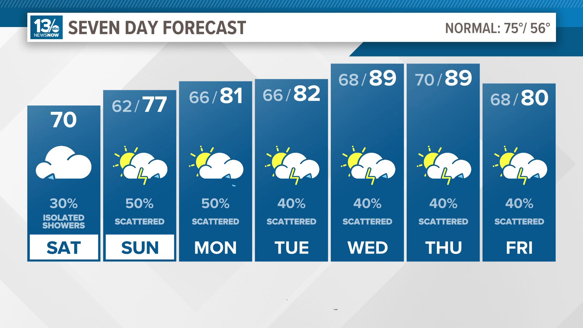
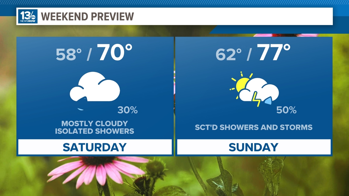
Saturday is trending in a cooler direction. The latest models have temperatures struggling to reach the upper 60s and lower 70s. Most of us will stay dry on Saturday, but we can't rule out isolated showers, especially the further north and west you live. More showers will develop late Saturday.
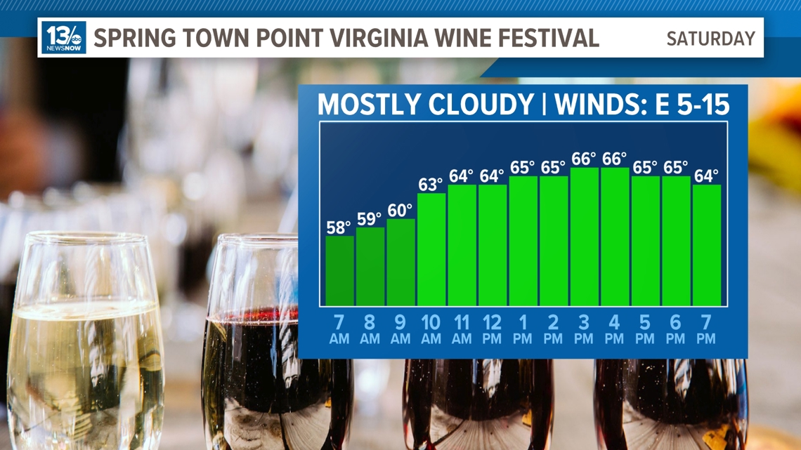
So if you're heading out to the Spring Town Point Virginia Wine Festival today, wear a jacket. Temperatures will run about 10° below normal with wind gusts up to 20 mph by the end of the event.

Another front arrives Sunday morning. This will bring a better chance of rain on Sunday. Sunday's rain may feature some thunderstorms. The rain looks to roll through from west to east from midday to 8 p.m. Winds will come from the south on Sunday though so highs will be warmer than Saturday, in the upper 70s and lower 80s.

The unsettled weather continues into the middle to late work week as a couple more fronts approach the mid-Atlantic. We could see a few thunderstorms mixed in with those showers.
Temperatures will rise throughout next work week into the upper 80s near 90.
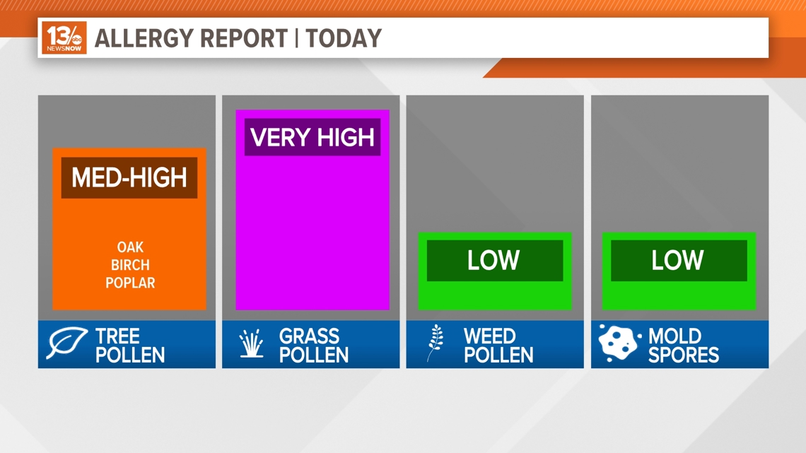
Allergy Report
Pollen levels will be moderate Thursday with oak and birch pollen as the predominant allergens. Pollen levels will rise again later this week. Grass pollen will be the worst allergen today with very high levels of pollen on Saturday.

Stay connected 24/7 via 13News Now